- Applications
- Tools
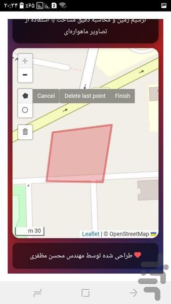
مساحت سنجی زمین
| Install | 4 K |
| From 11 Rates | 2.5 |
| Category | Tools |
| Size | 27 MB |
| Last Update | 2025 September 29 |
| Install | 4 K |
| From 11 Rates | 2.5 |
| Category | Tools |
| Size | 27 MB |
| Last Update | 2025 September 29 |
Images


Introduction
✨ Practical applications:
Precise measurement of agricultural land
Calculating the area of buildings and urban parcels
Development and urban planning
Use in civil engineering and surveying projects
✏️ 1. Intelligent land drawing
Ability to draw polygons on the map with a special tool
Ability to draw complex and irregular shapes
📏 2. Accurate area calculation
Measure the area of the drawn land with square meter accuracy
3. Satellite map display with multiple layers
Esri layer: High-quality and fast satellite images
USGS layer: Detailed satellite images from the US Geological Survey
Google layer: Google satellite images (very high resolution)
OpenStreetMap layer: Regular map with street details📱 4. Responsive design
🎨 5. Beautiful and user-friendly interface
Modern design with attractive color gradient
📍 6. Display of instant coordinates
Display coordinates (longitude and latitude) under the map
Automatically update the position when moving on the map
🧭 7. Auxiliary tools
Map scale (Scale Control) for visual measurement
Ability to zoom in and out with your finger on mobile
Automatic reset after new drawing
